> product // imgeo // live
ImGeo
photos into data.
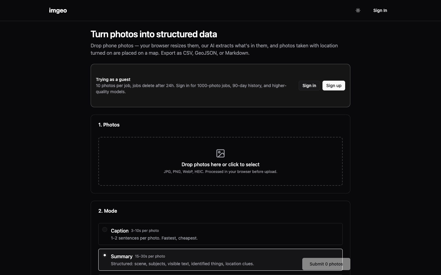
Turn phone photos into structured data. Drop photos in, AI extracts what is in them, and location-tagged shots land on a map. Export as CSV, GeoJSON or Markdown. Built for field workers and surveyors.
// sound familiar?
Field work generates hundreds of photos that mean nothing until someone sits down and types them into a spreadsheet. The data is in the shots; getting it out is the slow part.
// Field data
What it does
AI extraction
Photos become structured records: what is in them, read automatically.
Mapped by location
Geo-tagged shots place themselves on a map.
Export anywhere
CSV, GeoJSON or Markdown, ready for whatever is next.
- Photos become data without the manual transcription
- Location-tagged work shows up where it actually happened
- The export drops straight into whatever comes next
// how it works
- 01Drop phone photos in
- 02AI reads each one and extracts the structured record
- 03Geo-tagged shots place themselves on a map
- 04Export as CSV, GeoJSON or Markdown
// is this you?
Built for field workers and surveyors who shoot first and need it as data later.
Not for you if you need a full GIS platform with editing, layers and survey-grade precision. ImGeo turns photos into records, not a CAD seat.
// the build log
A tight April build
20 commits, April to May 2026, built to find out how good phone-photo extraction could get. Good enough to publish, and good enough that a field-services client now runs their own private fork. The prototype became a case study.
read the making of →Want ImGeo for your business?
Tell us what you need. We’ll give you a straight answer on whether it fits.